Professor Daniel Tong (associate director of the Center of Spatial Information Science and Systems) was elected as President-Elect of the GeoHealth Section of the American Geophysical Union (AGU) in 2022. He will become the...
Prof. Liping Di received the Lifetime Achievement Award from the InterNational Committee for Information Technology Standards (INCITS). https://www.incits.org/news-events/annual-awards#_ This is an award presented to no more than one INCITS participant annually, who has demonstrated...
Professor Liping Di has been elected as the convener of ISO TC211 Working Group 9: Information Management for a three-year term. (6/2020) https://committee.iso.org/sites/tc211/home/projects.html
How does the duct get from Africa to the U.S.? Will the color of sunrises and sunset get affected by the duct storm? Does it cause dry air and does it help with hurricane...
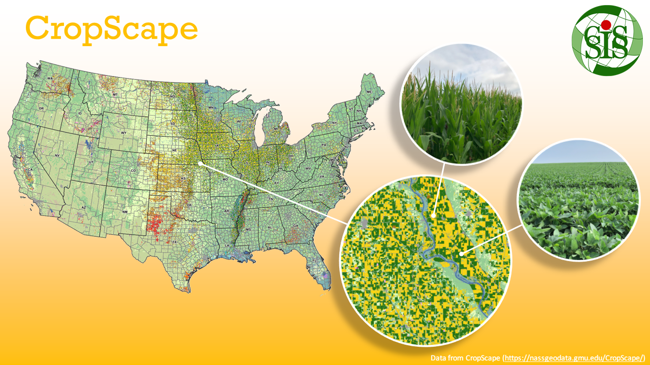
The 2019 Cropland Data Layer (CDL) was released by USDA NASS, including The national 2019 CDL. The national 2019 cultivated layer based on the most recent five years (2015-2019). The 2019 Crop Frequency Layer...